
Camera Inspections for Burlington's Post-War Ranches and Split-Levels
Burlington's core housing — 1950s–70s ranches, split-levels, and split-entry homes with a median build year around 1963 — runs cast-iron interiors with clay tile or Transite laterals that are now at the age where root intrusion and joint failure become routine. On camera, the typical findings are roots at clay joints, corroded cast iron at the house connection, and offsets from decades of freeze-thaw movement.
Split-entry homes often have longer, deeper runs from the raised sewer exit to the street main, so the camera's footage count matters: it records actual run length and depth, which is what the repair plan is built on. Full basements are the norm in this era's homes and many are finished living space, so inspections route through a cleanout to keep the lower level undisturbed.
Lots along the Vine Brook and Sandy Brook corridors — and near the town's wetland pockets — carry seasonal high groundwater, and the camera documents infiltration through open joints during wet conditions. Where a lateral runs near protected wetlands or brook buffers, open-trench work can trigger town permitting, so the inspection record is also what keeps a repair inside the existing pipe envelope.
Burlington's later infill colonials along the Middlesex Turnpike and Route 128 corridor complicate the picture — 1980s-and-newer builds typically run PVC, so a camera pass first establishes which generation of pipe is actually in the ground before any trenchless plan is drawn. Around Wheeler Road and Hilltop Drive, where the town has run storm-drainage projects, the footage also separates stormwater inflow from sanitary defects — a distinction that matters in a town laced with impaired brooks. And because so many Burlington basements double as finished living space, backups here are high-damage events; the camera survey functions as prevention, catching the root mass or offset joint before it becomes a flooded lower level.
Measuring Before Quoting: What the Camera Records on a Post-War Lateral
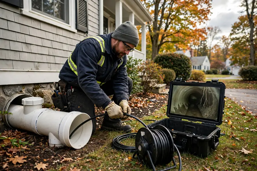
On a Burlington lateral, the camera's most valuable product is measurement. Pushed from the cleanout on a flexible cable, the camera head carries a distance counter and a transmitter: the counter records exactly how far each defect sits from the house, and the transmitter lets the technician trace the pipe's path and depth from the surface. In split-entry homes, where runs from the raised sewer exit to the street main are often longer and deeper than the footprint suggests, those numbers are what an honest repair plan is priced and drawn from — not a guess at the footage.
What the lens finds on this era's stock is predictable in outline and specific in detail. The broad pattern is cast-iron interiors with clay tile or Transite laterals, now at the age where root intrusion and joint failure become routine. The camera makes it concrete: roots at this joint, a corroded cast-iron connection at the house, offsets from decades of freeze-thaw movement at that depth. That specificity is what separates a lining candidate from a line that needs bursting or replacement — the footage shows structure, not just symptoms.
Near the brook corridors and wetland pockets, the pass adds a wet-weather dimension. Vine Brook, Long Meadow Brook, and Sandy Brook carry seasonally high groundwater, and the camera documents infiltration through open joints — water visibly entering the pipe. Where a lateral runs near protected buffers, that inspection record is also what keeps a repair inside the existing pipe envelope: trenchless methods scoped from video avoid the permitting complications that open-trench work would trigger near protected areas.
The 1963 Cohort, on Camera: Burlington's Ranch-Era Laterals
Burlington's core housing — 1950s–70s ranches, split-levels, and split-entry homes with a median build year around 1963 — is aging as one cohort, and the camera confirms it street by street. The recurring findings are roots at clay joints, corroded cast iron at the house connection, and offsets from decades of freeze-thaw movement. Transite laterals appear in this stock too, and the camera watches for the brittleness that aging cement-asbestos pipe develops — a different failure signature than clay's shifting joints.
Split-entry geometry shapes what the camera reports. The raised sewer exit means longer, deeper runs to the street main — more footage, more joints, more root exposure — and the distance readout maps every intrusion along the full run. That map is what lets a lining plan cover the affected length completely instead of stopping short. Full basements are the norm in these homes, and many are finished living space, so inspections route through a cleanout to keep the lower level undisturbed — and because backups here are high-damage events, the survey functions as prevention.
The town's water features add a third layer to the findings. Lots along the Vine Brook and Sandy Brook corridors sit on glacial till with seasonally high groundwater, and spring melt can push water into cracked laterals from the outside — the camera documents that infiltration during wet conditions. Around Wheeler Road and Hilltop Drive, where storm-drainage work has run, the footage also separates stormwater inflow from sanitary defects, a distinction that matters in a town laced with impaired brooks. And the later infill colonials along Middlesex Turnpike and Route 128 run 1980s-and-newer PVC — the camera first establishes which generation of pipe is in the ground before any plan is drawn.
The Burlington Camera Visit, Step by Step
Cleanout-routed access
The inspection starts at an existing cleanout, keeping the finished basement and landscaping untouched. Split-entry homes with raised sewer exits are scoped from the most practical access point, with interior routing planned around the lower level.
Measured video survey
The camera records the full run to the street main with a running distance count, logging material — clay, Transite, cast iron, or PVC — joint condition, root entries, offsets, and depth at each defect. The transmitter marks the pipe's path from above ground.
Infiltration documentation
On brook-adjacent and wetland-near lots, the pass documents groundwater entering through open joints during wet conditions, separating infiltration from structural defects so each gets the right fix.
Measured repair plan
You review the footage and the distance log with the technician, and the repair plan — lining, bursting, or spot repair — is drawn from the actual run length, depth, and defect map, with the video as the record the plan references.