
| ZIP | 01801 — primary standard ZIP for Woburn, MA (Middlesex County); secondary Woburn-assigned ZIPs are unique-use (01806, 01807, 01808, 01813, 01815) or PO Box only (01888) — 01801 is the only standard residential ZIP. Post offices: Woburn Center (2 Abbott St) and Woburn (462 Washington St). |
|---|---|
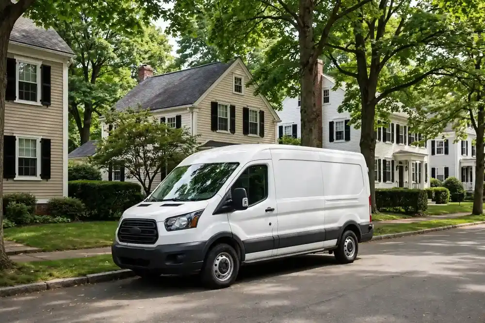
| Housing | Oldest city core of the four — late Georgian and Federal houses survive along Main, Elm, Lexington, Lowell, and Russell Streets (canal-era prosperity), with vernacular Federal twins west of the center. Woburn Center/Downtown mixes historic homes, multifamily, and condos; the West Side (Shaker Hill, Shaker Glen, Cummingsville) has postwar homes and newer construction; North Woburn mixes older and newer homes toward the Wilmington line. |
| Common pipe materials | The Federal/Georgian and 19th-century center stock: cast-iron interior drainage and clay or early-concrete building sewers, much of it well past design life; postwar West Side homes: cast-iron/copper interiors with clay or concrete laterals; late-20th-century infill: PVC. Typical for the era, never asserted for a specific home. |
| Foundations | Full basements are standard (stone, brick, block, and poured concrete across the eras); canal-era houses often have high stone foundations with shallow laterals under Main Street-side streets; postwar homes: poured basements or slabs; hillside lots (Shaker Hill, Horn Pond area): walk-out basements with daylight foundation exits. |
| Soil & drainage | The Aberjona River watershed covers most of Woburn, draining south through a heavily urbanized, channelized river corridor; low elevation near the southern city line. Glacial geology: north-south valleys filled with permeable sand/gravel outwash over impermeable till — shallow, easily recharged aquifers in valley fill, dense till on the uplands. Horn Pond and its brook tributary, plus the Wells G&H Superfund site area in North Woburn, mark zones of disturbed fill and shallow groundwater; tannery/leather-industry legacy left heavy-metal-contaminated sediments in the watershed. |
| Key routes/landmarks | Main Street is the historic civic/commercial spine (Woburn Common, City Hall, Woburn Public Library — a National Historic Landmark); Horn Pond Recreation Area (2.5-mile walking loop) anchors the southeast side; Route 128 (I-95) rings the west/south of the city, I-93 to the east; the Anderson Regional Transportation Center (Anderson/Woburn Station) provides commuter rail and Logan Express service. |
Woburn 01801: A Canal-Era Center on Industrial Ground
Woburn, Massachusetts is a city of many ZIP codes but one residential standard: 01801 is the primary standard ZIP — the secondary Woburn-assigned ZIPs are unique-use (01806, 01807, 01808, 01813, 01815) or PO Box only (01888) — with post offices at Woburn Center (2 Abbott Street) and 462 Washington Street. And 01801 contains the oldest city core of its group. Late Georgian and Federal houses survive along Main, Elm, Lexington, Lowell, and Russell Streets — canal-era prosperity built in brick and timber — with vernacular Federal twins west of the center. Woburn Center and Downtown mix historic homes, multifamily buildings, and condos; the West Side neighborhoods of Shaker Hill, Shaker Glen, and Cummingsville hold postwar homes and newer construction; North Woburn mixes older and newer homes toward the Wilmington line. For sewer work, Woburn is two cities: the canal-era center, and everything the city's industrial century left in the ground.
The Federal, Georgian, and 19th-century center stock typically carries cast-iron interior drainage and clay or early-concrete building sewers — much of it well past design life. Postwar West Side homes typically have cast-iron or copper interiors with clay or concrete laterals, while late-20th-century infill typically uses PVC. A sewer camera inspection is the only way to confirm what your lateral actually is, because Woburn's eras overlap street by street: a Federal twin on a canal-era street can sit two doors from a postwar infill on a replaced line.
Full basements are standard across the eras — stone, brick, block, and poured concrete. Canal-era houses often have high stone foundations with shallow laterals running under the Main Street-side streets; postwar homes sit on poured basements or slabs; hillside lots around Shaker Hill and Horn Pond have walk-out basements with daylight foundation exits. That last detail matters for repair method: a daylight exit on a hillside lot is a natural bursting or lining setup, while a deep lateral under a Main Street-side street is a different job entirely.
The ground is where Woburn's industrial legacy lives. The Aberjona River watershed covers most of the city, draining south through a heavily urbanized, channelized river corridor, with low elevation near the southern city line. The glacial geology runs north-south: valleys filled with permeable sand and gravel outwash over impermeable till — shallow, easily recharged aquifers in the valley fill, dense till on the uplands. Horn Pond and its brook tributaries, plus the Wells G&H Superfund site area in North Woburn, mark zones of disturbed fill and shallow groundwater. And the tannery and leather-industry legacy left heavy-metal-contaminated sediments in the watershed — which is why, in parts of Woburn, spoil handling is part of the sewer job, not an afterthought.
Weather loads this geology on a schedule. Nor'easters, freeze-thaw cycles, and spring snowmelt are the New England constants; the channelized Aberjona is flashy in heavy rain events, and low-elevation southern Woburn sees the most surface-water pressure. Intense summer thunderstorms drive short, high-volume inflow into aging laterals — the kind of event that finds every open joint in a clay run within an hour. Because the valley-fill aquifer recharges fast after storms, the water table around a lateral can swing dramatically in a single weather event.
The city's corridors orient the work. Main Street is the historic civic and commercial spine — Woburn Common, City Hall, and the Woburn Public Library, a National Historic Landmark, all anchor it. Horn Pond Recreation Area's 2.5-mile walking loop anchors the southeast side. Route 128 (I-95) rings the west and south of the city with I-93 to the east, and the Anderson Regional Transportation Center — Anderson/Woburn Station — provides commuter rail and Logan Express service. For crews, the map that matters divides Woburn into the canal-era center along Main Street, the hillside West Side, the Aberjona corridor, and North Woburn's industrial-ground neighborhoods.
How Sewer Services Work in Woburn
Woburn's industrial legacy makes sewer repair here different from its neighbors, and the difference starts underground. The Aberjona corridor and North Woburn sit on disturbed fill, shallow outwash aquifers, and former tannery and industrial ground. Camera inspection in these zones often finds collapsed or misaligned clay laterals in fill that will not hold an open trench without shoring — the trench walls slump, groundwater pours in, and the excavation becomes a bigger project than the pipe. That is why trenchless methods carry special weight in the corridor: pipe bursting and lining renew the line through its existing path, leaving the unstable ground undisturbed. And where soils are affected by the area's industrial past, spoil handling is planned as part of the job from the start — not discovered halfway through.
In the canal-era center along Main Street, the work looks different: lateral runs are deep, long, and stone-foundation-adjacent, with root intrusion and joint failure as the norm. These are century-plus clay and early-concrete lines under some of the city's oldest streetscapes. Open excavation here means deep trenches beside high stone foundations on busy streets — doable, but disruptive. Trenchless renewal is frequently the better answer technically as well as logistically, and a sewer line replacement in Woburn 01801 by bursting follows the deep existing path without undermining the foundation it runs beside.
The hillside West Side — Shaker Hill, the Horn Pond area — gives the third service geography: shorter runs with daylight foundation exits from walk-out basements. These are the most trenchless-friendly lots in the city. A bursting head or liner launched from a daylight exit can renew the run with minimal surface disruption, and the dense till of the uplands holds a work pit far better than the valley fill does. When the camera shows a failed clay or concrete lateral on a hillside lot, the recommendation is usually straightforward.
Because the valley-fill aquifer recharges fast after storms, wet-weather infiltration testing is how repairs get sized correctly in the low-lying zones. A lateral that camera-inspects as merely cracked in dry weather can show dramatic infiltration an hour after a thunderstorm — and the repair that seals the full run is sized to the wet-weather reality, not the dry-weather appearance. Our sewer maintenance planning for corridor properties is built around this: inspect in the conditions the pipe actually suffers, and the recommendation holds up when the next storm arrives.
One caution specific to Woburn's oldest streets: the deep, long laterals of the canal-era center sometimes cross property features — old stone walls, mature trees, extensions — that no longer match any available plan. The camera maps the actual path before anyone commits to a method. If your Woburn home predates 1900 and the drains are slowing, call (833) 713-2101 — the footage will show us the line's true route, and the repair will follow the pipe that exists, not the one the records suggest.
Common Sewer Problems in Woburn 01801
Collapsed and misaligned clay laterals in disturbed fill lead the corridor's list. In the Aberjona corridor and North Woburn, fill that was never properly compacted settles unevenly, and rigid clay pipe in settling fill cracks, shears, and drops out of alignment. The camera signature is distinctive: a pipe that is broken not by age alone but by ground movement — offset joints, sheared sections, bellies full of sediment. Because this fill will not hold an open trench without shoring, trenchless renewal through the existing path is usually the practical answer.
Joint failure and root intrusion dominate the canal-era center. The deep clay and early-concrete laterals along Main Street and its side streets have the century-plus joint catalog: separated, cracked, root-packed. Cast-iron interior transitions at high stone foundations corrode where they meet the exterior line. The symptom arc is familiar — slow drains, then recurring root blockages, then a section cleaning cannot clear — but the setting is not: deep runs beside historic foundations on busy streets, where every repair method is weighed against disruption.
Storm-driven infiltration is the third. The valley-fill aquifer's fast recharge means a summer thunderstorm can raise the water table against a cracked lateral within the hour, and infiltration pours in through every open joint. Low-elevation southern Woburn sees the most surface-water pressure, and the channelized Aberjona's flashy response to heavy rain sets the tempo. Homeowners experience it as backups that arrive with storms and vanish between them — the infiltration signature. A full-run seal, sized to wet-weather footage, is the fix that holds.
Frost and age complete the picture on the West Side and in North Woburn's mixed neighborhoods. Freeze-thaw cycles work the joints of postwar clay and concrete laterals, hillside lots shed water toward daylight exits that then carry infiltration, and late-20th-century PVC infill — where it exists — fails at joints disturbed by the same fill settlement that troubles the older pipe. Woburn asks for the full diagnostic toolkit because no two of its neighborhoods fail the same way.
First Steps When Sewer Trouble Hits in Woburn
If drains slow across the house, toilets gurgle, or a basement floor drain backs up, the first step is to cut water use: pause laundry, skip showers, hold the dishwasher. In the low-lying corridor neighborhoods, note whether the problem arrived with rain — that timing is diagnostic, and the crew will ask.
The next step is a camera inspection — and in Woburn, the footage is read against the ground, not just the pipe. In the Aberjona corridor and North Woburn, we look for the fill signature: offsets, shears, and bellies that point to ground movement, plus the depth and soil conditions that decide between trenchless and open methods. In the canal-era center, we map the deep run's actual path beside the stone foundation. In the lowlands, we want wet-weather footage showing infiltration as it happens. Tell the crew your street and the weather when the problem peaked; both shape the diagnosis.
Sewer Line Repair Works serves all of Woburn 01801, from the canal-era center to Shaker Hill to the Aberjona corridor. Call (833) 713-2101 and describe what you are seeing and where you are. We will schedule the inspection, show you the footage, and recommend the repair the ground and the pipe actually support — with spoil handling, shoring, and access planned upfront where Woburn's industrial ground requires it.
Services in This Area
Commercial Sewer Services in Woburn
Woburn, MA 01801.
Learn moreEmergency Sewer Repair in Woburn
Woburn, MA 01801.
Learn morePipe Bursting in Woburn
Woburn, MA 01801.
Learn morePipe Lining (CIPP) in Woburn
Woburn, MA 01801.
Learn moreSewer Camera Inspection in Woburn
Woburn, MA 01801.
Learn moreSewer Leak Detection in Woburn
Woburn, MA 01801.
Learn moreSewer Line Cleaning in Woburn
Woburn, MA 01801.
Learn moreSewer Line Installation in Woburn
Woburn, MA 01801.
Learn moreSewer Line Replacement in Woburn
Woburn, MA 01801.
Learn moreSewer Maintenance in Woburn
Woburn, MA 01801.
Learn moreTree Root Removal in Woburn
Woburn, MA 01801.
Learn moreTrenchless Sewer Repair in Woburn
Woburn, MA 01801.
Learn more