
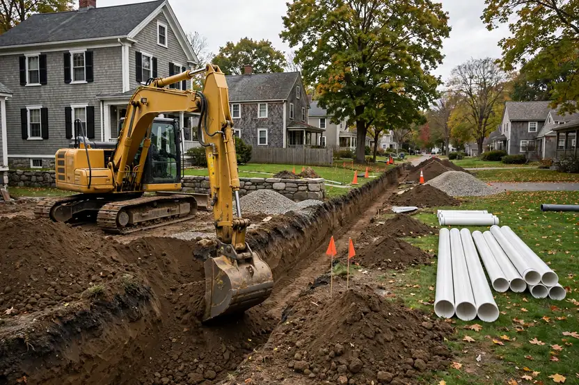
Sewer Installation in Salem's Historic Districts: Old Foundations, Tidal Flood Zones
Salem is a high-complexity installation market, and the complexity starts at the foundation. Half the housing stock was built before 1939, and the city holds one of the densest concentrations of pre-1900 domestic structures in the country. The Samuel McIntire Historic District alone contains 407 buildings. New sewer lines tied to those properties meet fieldstone and rubble-masonry or brick foundations with full basements, and those old masonry foundations are porous: many carry weeping-tile or footer drains tied into older combined sewers. The installation has to sort out that legacy at the building exit. The new lateral gets a clean, sealed connection that does not inherit the old foundation drainage's problems, and the work at the wall is hand care, not machine work, because 200-year-old masonry does not forgive a bucket.
The flood maps are the second constraint. FEMA designates AE zones along the North River and VE high-risk coastal zones at Forest River, Waikiki Beach, Willows Pier, Dead Horse Beach, and Collins Cove, with revised maps in effect since July 2025, and two tidal rivers raise inland flood risk near Salem State. A new line in those zones is installed with the water assumed present: dewatering, stone bedding in saturated ground, watertight joints along the full run, and backflow protection at the municipal tap where surge can push water back up the lateral. In the low-lying coastal pockets with very poorly drained mucky soils and water tables near the surface, the tap connection gets sealed at the main so groundwater cannot use the new lateral as a drain into the town system.
The streets themselves are a planning task. Narrow historic-district streets, landmarked Federal- and Georgian-era streetscapes, and condos carved from old single-family homes make equipment staging slow, and where surface disturbance touches a historic district, restoration is part of the estimate, not an afterthought. Salem's density also means the trench from building to main often crosses sidewalks, granite curbs, and old street fabric that goes back exactly as found. For the post-war infill and 1980s to 2000s renovations on PVC-era systems, the work is more straightforward, but the same discipline applies: trench through the till, stone bedding, continuous pitch verification, and a tap sealed watertight at the main.
Installing New Laterals Among Salem's Old Foundations
The installation begins at the masonry. On the pre-1900 properties, the foundation exit is exposed by hand through fieldstone, rubble, or brick, the old weeping-tile or footer drain connection is identified and separated from the new work, and the lateral's connection point is set through the wall with the design grade measured from that exact point. The porous old foundation gets a sealed penetration that keeps foundation drainage and the new sewer as two separate systems. From the wall outward, the trench is opened toward the street on an alignment that respects the narrow lot and the historic streetscape above.
Trenching in Salem is planned around what cannot be disturbed. The cut goes through glacial till and sandy glaciofluvial deposits to a uniform depth below design grade, with compact equipment on the narrow district streets and hand work near old curbs and sidewalks. Stone bedding is placed and graded, pipe is laid with the pitch confirmed at each joint, and watertight gaskets seal every connection. In the AE and VE flood zones along the North River, Forest River, and the coastal points, the trench is dewatered through laying and the bedding is stone sized for saturated, mucky ground.
The tap and the finish carry the flood-zone detailing. Backflow protection goes in at the municipal tap where surge or tidal rivers can push water back up the lateral, and the tap itself is sealed watertight at the main. In the low coastal pockets with water tables near the surface, that seal is what keeps groundwater out of the town system. The finished run is camera-verified, backfill is compacted in lifts, and the surface, sidewalk, granite curb, and historic street fabric, is restored exactly as found, because in the districts the restoration is part of the installation.
Salem: Old Houses, Tidal Rivers, Mapped Flood Zones
Salem's housing is among the oldest in the country: 50 percent of units were built in 1939 or earlier, and the city's housing profile reports 56 percent of units in buildings from before 1939. Only about a quarter of the stock is single-family detached, with a dense urban mix including large apartment buildings. The city holds one of the greatest concentrations of pre-1900 domestic structures in the United States: the McIntire district's 407 Federal, Georgian, Greek-revival, and Colonial-revival buildings, plus the Chestnut Street and Salem Common districts, with 600-plus buildings in local historic districts and more than a thousand on the National Register.
The ground is Essex County glacial till and sandy glaciofluvial deposits over granite and gneiss bedrock, with very poorly drained mucky soils and water tables near the surface in the low-lying coastal pockets. Flood exposure is significant and mapped: FEMA AE zones along the North River, VE high-risk coastal zones at Forest River, Waikiki Beach, Willows Pier, Dead Horse Beach, and Collins Cove, with revised maps effective July 2025. Two tidal rivers, the Forest and South Rivers, increase inland flood risk and sea-level-rise pressure near Salem State.
Foundations in the pre-1900 homes are typically fieldstone, rubble-masonry, or brick with full basements, and the old masonry is porous, often with weeping-tile or footer drains tied into older combined sewers. Weather is the New England coastal pattern: powerful fall and winter nor'easters driving coastal flooding, freeze-thaw cycles shifting soil around old laterals, and spring melt saturating soils and raising water tables. New installations are engineered for all three: old masonry handled by hand, water assumed present, and every surface restored.
The Salem Installation Process
Masonry-first survey
We expose the foundation exit by hand, separate old foundation drains from the new work, and set the design grade from the wall.
Careful trenching
The trench is cut with compact equipment on narrow district streets, through till to uniform depth, with dewatering in flood zones.
Bedding and sealed pipe
Stone bedding is graded, pipe is laid with pitch confirmed per joint, and watertight gaskets seal the run.
Flood-zone tap and restore
Backflow protection and a sealed tap finish the connection, the line is camera-verified, and historic surfaces are restored exactly.